The Missing 49 Kms in New Zealand
 [article from Stuff] – Somewhere, somehow, 49 kilometres have gone missing in New Zealand. Government agencies don’t know where they are. Neither do a range of local boards, experts and transport policy wonks.
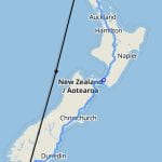
But what we do know is this: at opposite ends of the country, in Bluff (in the south) and Cape Rēinga (in the north), two iconic road signs give very different numbers for how far it is from one end of the country to the other. I’d been in Invercargill for a week – I grew up in the deep south – and popped out to Stirling Point in Bluff for old times’ sake. Many a childhood Saturday was spent around that sign, fish and chips in hand, as biting southerlies blew from Antarctica.
I snapped a pic of the sign: 1403km to Cape Rēinga.
The next weekend, having zipped the length of the country, I was in Cape Rēinga with a friend who was visiting from the UK. This was, I enthused, the perfect chance to get a matching set of pictures.
I lined up my shot beside the lighthouse, zoomed in, and… wait a minute: 1452km to Bluff. Why the difference? Isn’t it simple Mathematics to get this correct? Well, it seems not. Read more here.
